 |
| ITRS and ITRF | |
| ITRF NEWS | |
| General concepts | |
| Splinter meeting | |
| ITRF Products | |
| ITRF solutions | |
|
Transformation parameters |
|
| VO Corner | |
| Domes Numbers | |
|
DOMES description DOMES request |
|
| IERS Network | |
| Network description | |
| Local surveys | |
| Site Information and Selection | |
| Get ITRF coord. | |
| Get coordinates | |
| Selected points | |
| ITRF Mailing list | |
| FAQ | |
| Links | |
| Site map | About this site | |

 |
|
Terrestrial Reference System |
|||
|
Definitions A Terrestrial Reference System (TRS) is a spatial reference system co-rotating with the Earth in its diurnal motion in space. In such a system, positions of points anchored on the Earth solid surface have coordinates which undergo only small variations with time, due to geophysical effects (tectonic or tidal deformations). A Terrestrial Reference Frame (TRF) is a set of physical points with precisely determined coordinates in a specific coordinate system (cartesian, geographic, mapping...) attached to a Terrestrial Reference System. Such a TRF is said to be a realization of the TRS. Three main concepts are identified as follows:
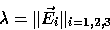
An ideal Terrestrial Reference System (TRS) is defined as a tri-dimensional reference frame (in the mathematical sense) close to the Earth and co-rotating with it. In the newtonian background, the geometry of the physical space considered as an euclidian affine space of dimension 3 provides a standard and rigorous model of such a system through the selection of an affine frame (O,E). O is a point of the space named origin. E is a vector base of the associated vector space.The currently adopted restrictions to E are to be orthogonal with same length for the base vectors. Moreover, one adopts a direct orientation. The common length of these vectors will express the scale of the TRS and the set of unit vectors collinear to the base its orientation:
In the context of IERS, we consider the geocentric systems where the origin is close to the geocenter and the orientation is equatorial (Z axis is the direction of the pole). In this case, cartesian coordinates, geographical coordinates or plane (map) coordinates are currently used. |
|||
|